|
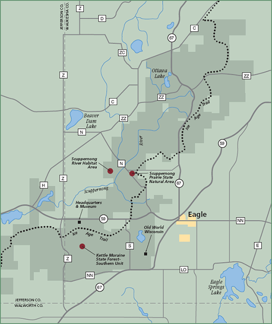
Kettle Moraine State Forest - Southern Unit, Scuppernong River Habitat Area and Scuppernong Prairie State Natural Area The southern unit of the KMSF is 30 miles long and totals 20,000 acres. It straddles three counties – Waukesha, Jefferson and Walworth. Within its boundaries lies the 3,500-acre Scuppernong River Habitat Area, the largest mesic prairie east of the Mississippi River, and the very diverse Scuppernong Prairie SNA. The Ice Age National Scenic Trail meanders through the entire length of the property. Wildlife viewing here is exceptional at any time of the year. Standing among the wildflowers on the Scuppernong Prairies and hearing the call of grassland birds is aweinspiring. You’ll want to revisit this area throughout the seasons. Directions: From Eagle in Waukesha County, the best access is north on Hwy 67, west on Hwy 59, or north on Hwy N – headquarters and museum off Hwy 59. Gazetteer: Page 30, A-1/2 (prior to 10th edition). | Page 94, A-3 (10th edition). Phone: 262/594-6200 (Kettle Moraine State Forest Headquarters). Web site: WDNR Kettle Moraine State Forest - Southern Unit | WDNR Scuppernong River Habitat Area | WDNR Scuppernong Prairie State Natural Area Signature species: Bobolink, Western Meadowlark and Shorteared Owl. Rare species: Upland Sandpiper, Franklin’s Ground Squirrel and Badger. Parking: Parking lots. Nearest food & lodging: Eagle and Whitewater.
|